While minding our own business in the Tarentaise Valley last weekend (supporting a group for the Etape du Tour), John and I heard about a ‘new col’ in the vicinity. Intrigued, after dropping our riders off in Albertville in the early morning for their race, we hustled back to Moutiers, hopped on our bikes and went out to find out what all the fuss was about. Spoiler alert: there is a lot to fuss about.
First, from Moutiers (not the official start), it was a 35 km climb, with an elevation gain of 1825 m (actually over 2000…we got lost in Courchevel), making it a monster of a climb. The real beginning of the Col de la Loze, however, is at the turnoff for Courchevel on the D119, taking a few hundred meters off ours.

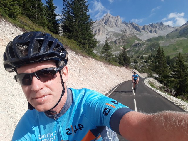
Most of the climb is the old ski station access road to Courchevel, but around the ‘altiport’ above the last village, you come to this sign (less blurry in real life). The sign says that the last 6 km of the road are for non-motorized vehicles. It’s the same on the other side of the mountain, making this stretch of pavement the highest cycling path in Europe, perhaps.

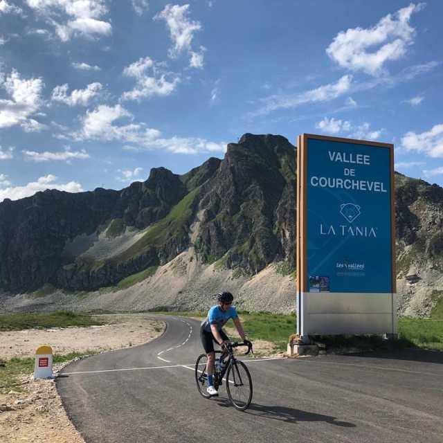
This region is far from remote mountains and is one of the biggest ski areas in the Alps. There are 3 valleys housing 3 famous ski stations – Courchevel, Meribel and Val Thorens (the finish of today’s truncated TDF stage) – and the plan is to connect them all with ‘cycling cols’, I think. The Loze is the first step.

A little word on road engineering. If you don’t need to worry about cars driving on your tarmac, you can do just about anything you want, which is exactly what has happened here. The road is more like a roller coaster that follows the contours of the mountain. It’s a rush when things go downhill, but not so much when they go up. I hit 18% a couple of times and the Meribel side has 24%!
At the top of the climb we struck up a conversation with a local rider who told us how this idea came to fruition (campaigning from his club, with an amenable local government), as well as their future plans.
There will be another col that should connect Meribel to Val Thorens, making a ‘3 Valleys’ ride that will be spectacular, but the big exciting news for me was an extended plan to pave a 3000 meter road from one of these valleys over to the Maurienne Valley to the south, which would be the highest col in Europe and would just be another cool way to go north-south through the French Alps (the Madeleine is the other way now in that area). Exciting times.
Note: A few months after writing this article, the inevitable happened, and the Col de la Loze was announced for next year’s Tour de France (Stage 17 on July 15th). Summit finish, obviously.
COL DE LA LOZE
Elevation at start: 845 m.
Elevation at finish: 2304 m
Total elevation gain: 1459 (Ventoux is only 200 m more, as comparison)
Distance: 22.5 km (same as Ventoux)


Let us know when you add La Loze to your burgeoning list of tour selections.
Sam, we already have one that stays in the valley at the bottom of the climb. An easy fix!
I had no idea they were still building cols. One would have thought that after a couple millenia of occupation, they would have been developed by now! This is the most exciting news since you informed me that Mount Ventoux is shrinking!
It was a surprise to me, too, Steve. It gives me hope for humanity!
I have solved the lack of new cols round us by finding the old ones steeper every time I visit them. Yours looks wonderful.
I’m sure yours are pretty good, too, TP. One day I’ll find out…
Fab news!