I love maps. Maps are probably the reason I started my bike tour company because I don’t get tired of looking at them for route possibilities. I also like to know where I’ve been and where I’d like to go next. In the old days this meant highlighting a paper Michelin map, but now we have heatmaps, which helps alleviate the frustration of trying to refold the Michelin.
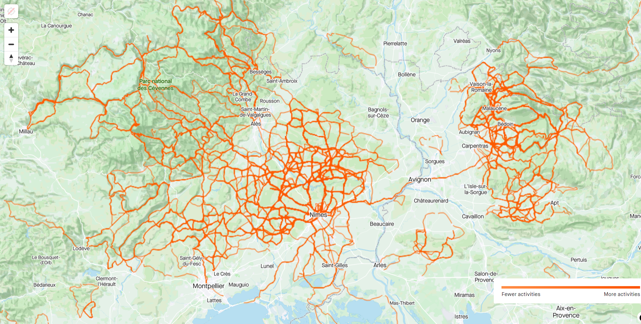
Above is my personal heatmap that comes with a paid Strava account. These two zoomed-in ‘red’ areas are Nimes and the Cévennes (west side of the Rhone river), where I train and work sometimes; and the Ventoux area (right side), which is where I spend a lot of time in the spring, summer and fall with clients. I’ve been on Strava since 2013, so have compiled a healthy number of red lines of various ‘hotness’.
Other than seeing what I’ve done, the personal heatmap allows me to know what I’ve missed, like a short stretch of road in the hills above Ales that I’m going to ‘fill in’ on Friday. It also answers the question of whether I’ve ridden a portion of road or not – something that comes up quite a lot in my business and which I often don’t know the answer to. My heatmap will tell me, as long as it was ridden after 2013.

Try VeloViewer tiles, it’ll encourage you to explore new areas.
Will check that, thanks
There is a velovewier plug in to strava that will show you which tiles you haven’t yet entered while you are planning a strava route. Super great to help plan rides to explore new areas. While you’re planning the route, it will color each potential new tile yellow so you can see how many new tiles a new route will give you.
I also like veloviewer’s infographic page.
I’ve got the window open now…will check after lunch!
That’s some good coverage!
There are lots of roads in France.
Interesting. I must look at mine.
You might be impressed by how much you get around, especially if you include walks on Strava.