I ventured out of Nimes the other day to buy some hiking boots and ended up leaving the store with more than I’d planned on. I used to work at an outdoor store and I still get a warm feeling when I visit one these days. An outdoor shop represents freedom, with all their travelling gadgets, fleecy jackets and, of course, maps.
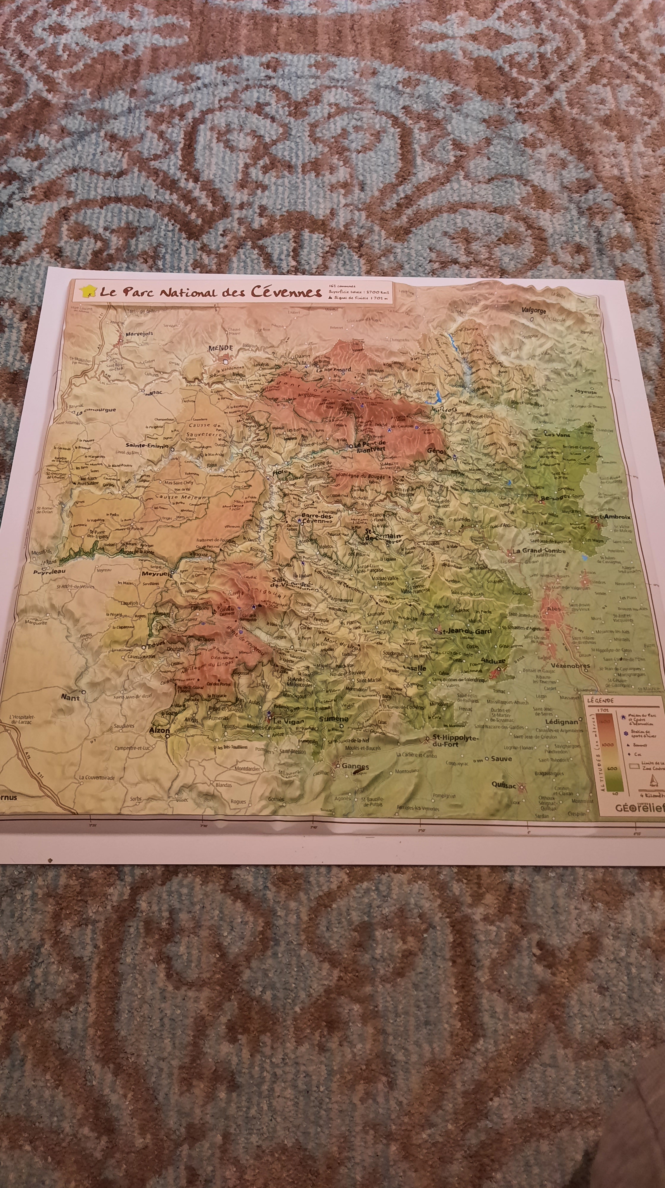
This is a relief map of the Cévennes that has actual relief, instead of just colors and shading. I’m sure there’s a name for this sort of thing, so feel free to educate me. You can see the 3 distinct geographical areas of the mountains quite nicely here:
1. Starting in the northwest, with the causses, high limestone plateaux, bordered by deep gorges.
2. The 2 dark-brown lumps in the middle are the massifs of Mont Aigoual and Mont Lozère.
3. The southeastern area is the ‘real Cévennes’, most likely thus named by someone who lived there. This is closest to home for me and where I do most of my riding when I venture up there. Here’s a close-up.
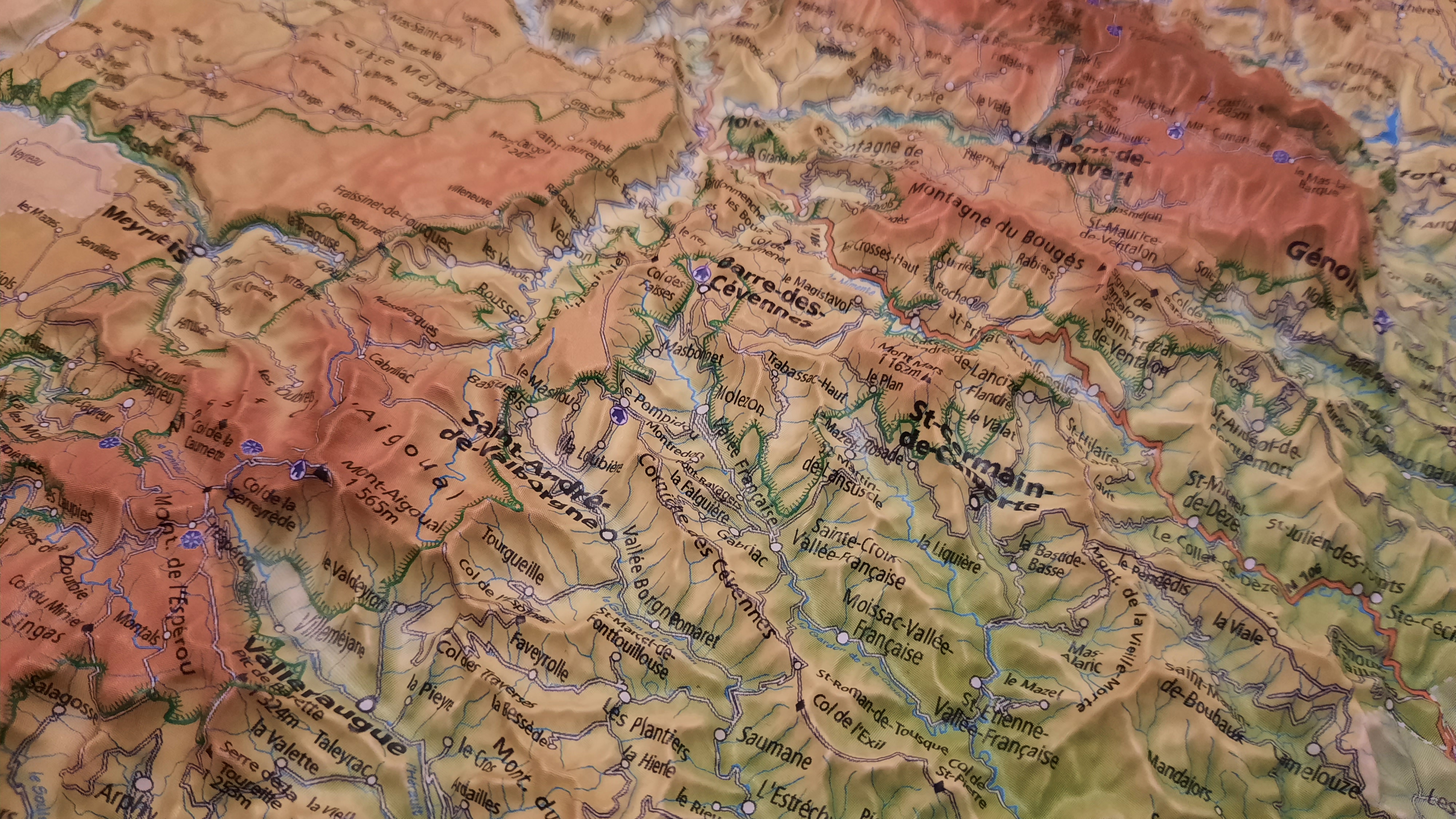
You can count at least 6 rivers valleys cutting down in the same direction. All of these valleys are very sparsely populated and all of them have roads, as you can see if you squint. Even better, they are all connected to each other by roads that make you climb. For the right type of cyclist, this is paradise.
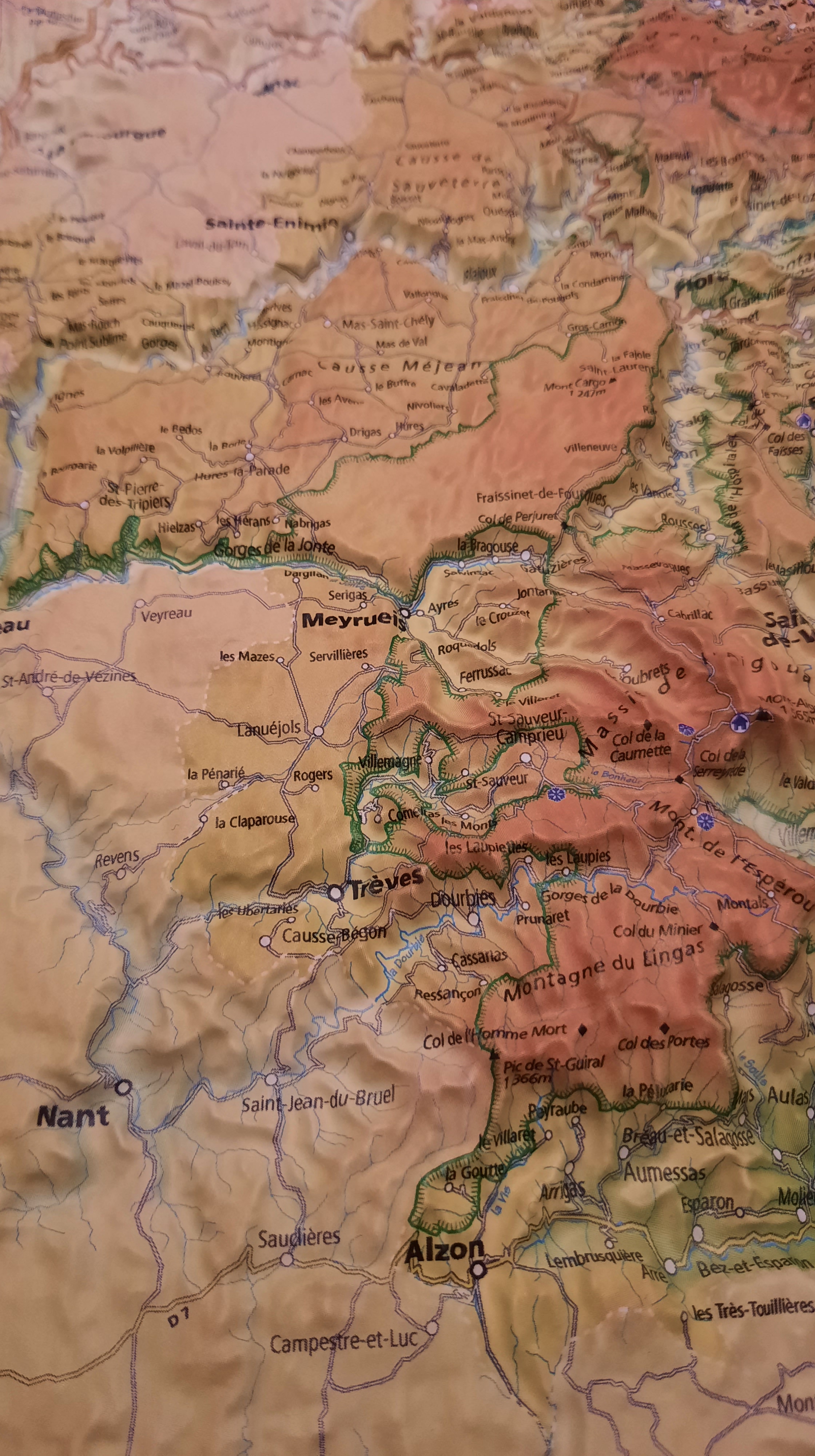
Here’s a zoomed-in shot of the causse area (and Mont Aigoual) to give you some idea of variety. Up here you find fewer roads (but still plenty) and bigger climbs and the contrast between the lush gorges and the dry, deserted plateaux is pretty stunning. It’s all wonderfully compact, too – the length of that middle causse (Méjean) is only about 50 km. When you’re allowed to come to France in the future, put this one on your list.

Physical maps are extra satisfying now that so many of our habitual map resources are on line. Totally agree. I would have bought that in a heartbeat, too.
I’ve had a much bigger one on the radar for ages, but this one will fit on the wall and didn’t break the back. Didn’t think too much before buying.
That is a pretty nifty map. I too love visiting outdoor stores–Mountain Equipment Co-op here in Canada. I always leave with more than I planned and even though I worry about how much I spent on the drive home, that feeling is usually replaced by the warm fuzzies thoughts of adventures by the time I pull into the driveway.
I became a member of the original MEC in Vancouver back in 1991. Never have received any dividends! Also never had many regrets from my purchases
That is a wonderful map. I still can’t believe neither HerrKaa nor I have yet to cycle there. Smart move on snatching up the map: we were admiring a relief map of Brittany last fall in one of the many many Vieux Campeur, but now both store and map are gone!
It’s a little small, but I’ve got glasses. K has ridden there and even climbed Mont Aigoual. Remember the famous 50450 trip!?
Would love to stay in Meyrueis again. Cycling mecca.
Great base. Do you remember where you stayed? One of the tightest-run restaurants in the region in in that village. Hankering to go back for a meal!
Great map. A good buy.