On my ride up north today I decided to go around the back side of Mont Bouquet (the evilest little mountain in the vicinity) and climb from the north for the first time.

 This stretch is lovely and lonely and over 10%, which you think is pretty steep till later on.
Further up, my eye caught a new splash of color on the side of the road.
My department (Gard) has been quietly planting these great little cycling bornes on climbing routes recently. Well, I can only think of two, but it’s a good start. If you ride in the Pyrenees or the Alps these things are everywhere, telling you how much pain you’re in for over each and every kilometer you climb. At right you see the last 700 meters is an average of 10%, which is pretty steep. That’s misleading, though, because part of it is flat and part of it is nearly 20%. There’s a difference.
Another new find on my climb was a col I had no idea existed till today.
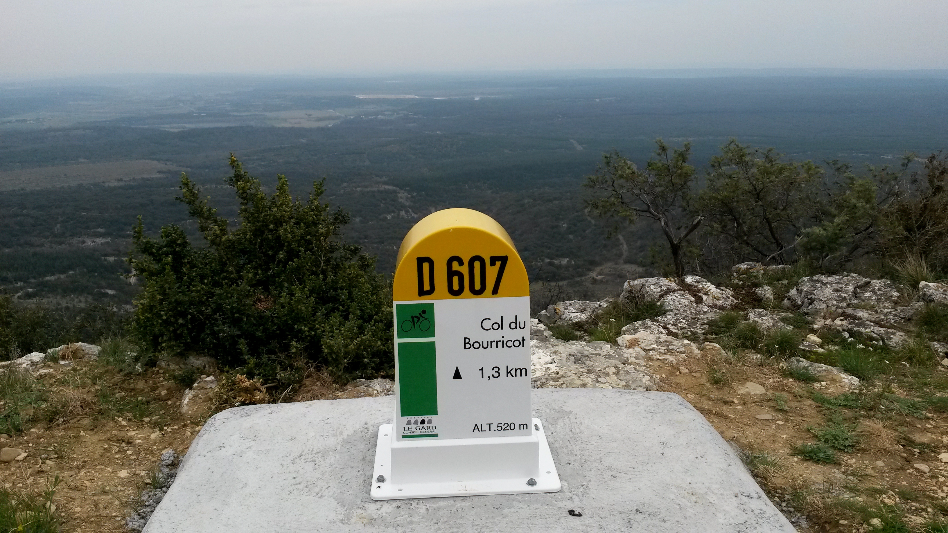
The Col du Bourricot, elevation 520 meters, is near the summit, but I never would have thought to call it a mountain pass. Apparently it is, however, as this sign to the left of the new one attests to. Now how did I miss that one before..?


I quickly learned on the Haute Route that those bornes don’t necessarily tell the whole story. Some hills would advertise say, 6% but after the flat section in the middle you knew you knew you were in for some pain. They did offer comfort at times – 4% for the next kilometres- fantastic. Only 19 more kilometres.
I can’t decide if they make life better or worse either.